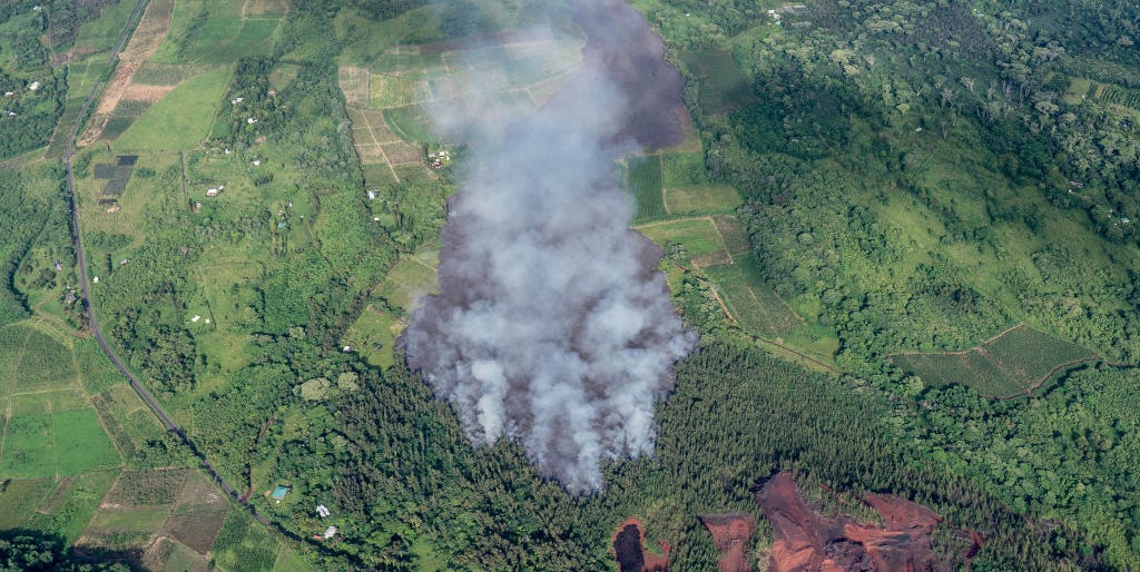
For decades, Kīlauea had a reputation as the approachable member of the volcano family. It erupted frequently, produced photogenic rivers of lava, and generally behaved more like a slow-moving geological celebrity than a cinematic supervillain. Then 2018 arrived, and the volcano dramatically revised its résumé.
Between May and August, Kilauea’s 2018 eruption sent enormous volumes of lava through Hawaiʻi Island’s Lower East Rift Zone, buried neighborhoods, transformed the coastline, released record-breaking quantities of sulfur dioxide, and caused the volcano’s summit to collapse in a sequence scientists had never observed with such detail. Instruments recorded nearly every shudder, chemical change, gas pulse, and movement of magma.
Calling the event “unprecedented” does not mean that nothing similar had ever happened in Earth’s history. Calderas have collapsed before, and Kīlauea has produced major eruptions in the past. What made 2018 extraordinary was its scale in modern Hawaiian history, the unusual coupling between a distant fissure eruption and summit collapse, and the astonishing amount of scientific data collected while everything unfolded.
How Kilauea’s 2018 Eruption Began
Warning signs appeared beneath Puʻuʻōʻō
Before 2018, Kīlauea had already been erupting continuously for decades. The Puʻuʻōʻō eruption began in January 1983 and continued for approximately 35 years, becoming the longest and most voluminous known East Rift Zone eruption at Kīlauea in at least five centuries.
By March and April 2018, monitoring instruments detected increasing pressure beneath Puʻuʻōʻō. The crater floor rose, earthquake activity changed, and scientists warned that magma might break into a new underground pathway. On April 30, the floor of Puʻuʻōʻō suddenly collapsed. That event effectively marked the end of the long-running eruption and the beginning of a much larger crisis.
Magma began migrating eastward through Kīlauea’s rift system. Earthquakes traced its underground journey toward the populated Lower Puna area, functioning like a very noisy tracking device. Residents felt repeated shaking as molten rock forced open fractures several miles below the surface.
Lava reached residential neighborhoods
On May 3, 2018, the first eruptive fissures opened in Leilani Estates. Steam, volcanic gases, and lava emerged through cracks in roads, yards, and wooded lots. Evacuations were ordered as additional fissures appeared across a fracture zone approximately 4 miles long.
A magnitude 6.9 earthquake struck the following day. It was the strongest earthquake in Hawaiʻi since 1975 and resulted from movement along Kīlauea’s south flank. The earthquake damaged buildings, triggered rockfalls, and made an already frightening situation feel as though someone had checked every box on nature’s disaster menu.
Eventually, 24 fissures opened in the Lower East Rift Zone. Some erupted only briefly. Others produced lava fountains and flows that advanced through subdivisions, forests, farms, roads, and utility corridors.
Fissure 8 Became the Eruption’s Main Engine
By late May, one vent known at the time as Fissure 8 had become dominant. It was later given the Hawaiian name Ahuʻailāʻau. The vent produced sustained lava fountains and fed a fast-moving channel that carried molten rock toward the ocean.
At peak activity, the eruption discharged more than 100 cubic meters of lava per second. That is roughly enough material to fill a large backyard swimming pool every second, although swimming was strongly discouraged for several obvious reasons.
The lava channel developed raised sides called levees, allowing it to transport lava efficiently over long distances. Unlike a broad, sluggish flow front, this channel behaved like a glowing volcanic river. Overflows occasionally escaped the channel, creating fresh hazards and threatening areas that had previously appeared safe.
On June 3, lava entered Kapoho Bay. It buried coastal communities, filled much of the bay, destroyed tide pools, and created hundreds of acres of new land. The coastline was not merely damaged; it was redrawn.
The Summit Was Collapsing at the Same Time
The lava lake drained away
While lava erupted nearly 25 miles away in Lower Puna, remarkable changes were occurring at Kīlauea’s summit. The lava lake inside Halemaʻumaʻu crater began dropping as magma drained from the shallow summit reservoir and moved into the rift zone.
As pressure decreased underground, the rock above the reservoir lost support. Sections of the caldera floor began sinking. The process was not one smooth collapse. Instead, the summit dropped in repeated, step-like events.
Scientists documented 62 major collapse events between May and early August. Many released seismic energy equivalent to earthquakes between approximately magnitude 4.7 and 5.4. Tens of thousands of smaller earthquakes accompanied the sequence, rattling Hawaiʻi Volcanoes National Park day after day.
A caldera collapse observed in extraordinary detail
By the end of the sequence, parts of Kīlauea’s summit had subsided by more than 1,600 feet. The total collapse volume was about 0.8 cubic kilometers. Roads cracked, overlooks disappeared, buildings were damaged, and familiar sections of the national park became unrecognizable.
The collapse provided scientists with a rare opportunity. Caldera-forming events are usually reconstructed long after they happen by examining ancient rocks. At Kīlauea, researchers watched one occur using seismometers, GPS stations, tiltmeters, gas instruments, thermal cameras, drones, aircraft, and satellites.
The result was one of the most complete scientific records ever collected during a basaltic caldera collapse.
Why Scientists Called the Event Unprecedented
The scale exceeded modern expectations
The 2018 Lower East Rift Zone eruption was Kīlauea’s largest rift-zone eruption in at least 200 years. Approximately 1.5 cubic kilometers of lava erupted, covering about 35.5 square kilometers, or more than 8,700 acres.
More than 700 structures were covered by lava, including hundreds of homes. Roughly 30 miles of roads were buried, damaged, or cut off. Thousands of residents were initially displaced, while farms, schools, waterlines, electrical systems, and businesses suffered major losses.
Despite the destruction, the eruption caused no direct fatalities. Advance warnings, evacuations, continuous monitoring, and cooperation between scientists and emergency officials played essential roles in protecting lives.
The summit and rift eruption formed a connected system
The eruption demonstrated that activity at one part of Kīlauea could strongly influence another part many miles away. Magma escaping through the low-elevation Lower East Rift Zone reduced pressure beneath the summit. The summit then collapsed in increments, and each collapse pressurized the remaining magma system.
Research suggests that these pressure pulses helped sustain lava discharge at the distant vent. Scientists detected cycles in which summit collapse events were followed by measurable changes in lava output. The volcano behaved as an interconnected hydraulic system rather than a collection of independent vents.
The low elevation of Ahuʻailāʻau was especially important. It sat more than 3,000 feet below the summit. Once a stable pathway formed, the elevation difference helped drive magma downslope through the rift, much as pressure moves fluid through a pipe. The comparison is imperfect, of course, because household plumbing rarely produces lava fountains.
Researchers collected data in near real time
Scientists sampled fresh lava repeatedly throughout the eruption. Laboratory analysis revealed that the earliest flows contained cooler, older magma that had been stored within the rift zone. Later lava became hotter and reflected fresher magma arriving from deeper parts of Kīlauea’s system.
These chemical changes mattered operationally. Hotter lava could remain fluid longer, travel farther, and feed faster-moving flows. Near-real-time geochemical monitoring therefore offered information that could help scientists explain changing hazards to emergency managers.
Gas, Ash, Vog, and Ocean Hazards
Sulfur dioxide reached record levels
Lava was only one part of the emergency. The Lower East Rift Zone released nearly 200,000 metric tons of sulfur dioxide per day during periods of peak activity, the highest emission rates ever measured at Kīlauea.
When sulfur dioxide reacts with moisture, oxygen, sunlight, and particles in the atmosphere, it forms volcanic smog known as vog. Vog can irritate the eyes and throat, reduce visibility, damage crops, and worsen respiratory or cardiovascular problems. Winds carried pollution across much of Hawaiʻi and, at times, far beyond the islands.
Satellite instruments operated by NASA and other agencies mapped sulfur dioxide plumes from orbit. These observations helped scientists follow emissions across areas that ground-based sensors could not fully cover.
Ash explosions shook the summit
As the summit lava lake drained, scientists initially worried that groundwater might interact with hot rocks and produce violent steam-driven explosions similar to events at Kīlauea in 1924. Explosions did occur, including one that sent ash roughly 30,000 feet above sea level on May 17.
However, the most catastrophic explosion scenarios did not happen. Later analysis indicated that magmatic gases, falling rocks, and pressure changes within the collapsing crater played important roles in generating many of the ash plumes.
Lava entering the ocean created new dangers
When lava met seawater, it produced acidic steam clouds known as laze. These plumes could contain hydrochloric acid and tiny volcanic-glass particles. Lava deltas built along the coast were also unstable and capable of collapsing without warning.
The eruption produced unexpected ecological effects as well. Research led by University of Hawaiʻi scientists found that lava-heated seawater helped bring nutrient-rich deep water toward the surface. Combined with volcanic material, those nutrients contributed to a large offshore phytoplankton bloom.
Even while destroying ecosystems on land, the eruption created unusual biological activity at seaa reminder that volcanoes are excellent at making simple stories complicated.
How the Eruption Changed Volcano Science
Kilauea’s 2018 eruption became a natural laboratory for studying magma transport, caldera collapse, earthquake generation, gas release, lava chemistry, coastal change, and disaster communication.
Drones allowed scientists to inspect dangerous areas without placing crews beside unstable crater walls or active lava channels. Thermal cameras showed where lava was moving beneath cooled surfaces. GPS instruments measured ground movement, while gravimeters detected changes caused by shifting magma and draining lava lakes.
The collapse cycles have since been used to test forecasting methods, including machine-learning systems that analyze deformation and seismic signals. Researchers have shown that portions of the collapse sequence contained repeatable patterns that could sometimes indicate when the next major event was approaching.
That does not mean computers can now predict every volcanic collapse. Volcanoes remain stubbornly opposed to convenient scheduling. However, Kīlauea demonstrated that dense monitoring networks can reveal physical patterns hidden inside an apparently chaotic crisis.
The Human Cost Behind the Scientific Opportunity
Scientific excitement should never obscure what the eruption meant for Lower Puna. Families lost houses, land, possessions, farms, community spaces, and access roads. Some properties that escaped burial became unreachable because surrounding roads had vanished beneath thick lava.
County assessments identified hundreds of millions of dollars in housing, infrastructure, agricultural, tourism, and business losses. Waterlines, utility poles, schools, and public roads had to be restored or rerouted. Years later, recovery projects continued because rebuilding around fresh lava is not a weekend renovation involving a cheerful trip to the hardware store.
The eruption also reinforced the importance of listening to local knowledge and respecting the cultural meaning of volcanic landscapes. For many Native Hawaiians, Kīlauea is not simply a hazardous geological machine. It is part of a living cultural and spiritual landscape connected to Pelehonuamea, genealogy, place, and responsibility.
Experiences and Lessons From Living Through an Unprecedented Eruption
For residents, uncertainty became part of daily life
One of the defining experiences of the 2018 eruption was not a single dramatic lava fountain. It was the uncertainty that continued from one day to the next. A fissure might stop erupting, only for another crack to open nearby. A house could appear safe in the morning and face a new flow direction by evening. Roads that served as evacuation routes could suddenly be threatened or buried.
Residents learned to keep vehicles fueled, documents packed, medications accessible, and animals ready to move. Emergency alerts became part of the daily routine. Sleep was interrupted by earthquakes, helicopter flights, evacuation messages, and the distant glow of lava reflecting against clouds.
Vog created another layer of stress. Even people living away from the active fissures experienced irritated eyes, sore throats, headaches, and concerns about children, older relatives, and family members with asthma. Air quality could change with the wind, meaning that conditions were never determined by distance alone.
Scientists experienced a race between discovery and public safety
For volcano scientists, the event offered remarkable observations under extremely demanding conditions. Field teams collected hot lava samples, installed instruments, mapped flows, measured gases, and interpreted data while the hazard changed around them.
Researchers had to communicate what was known without pretending to know more than the evidence allowed. Explaining uncertainty became as important as explaining magma. Residents wanted direct answers: Would lava reach a specific road? Would another fissure open? When would the eruption end? In many cases, science could identify trends and probabilities but could not provide a precise yes, no, or Tuesday-at-three answer.
The experience showed why trustworthy hazard communication requires honesty. Saying “we do not know yet” can be frustrating, but it is more useful than offering confidence unsupported by data.
Remote observers saw beauty and destruction at once
People following the eruption through livestreams, satellite images, photographs, and news reports often felt two conflicting reactions. The lava fountains were visually magnificent. Rivers of incandescent rock demonstrated planetary forces usually hidden beneath the ground. At the same time, those same flows erased homes and neighborhoods.
That tension is central to experiencing volcanic events responsibly. Lava is not special effects. A spectacular image may represent someone’s street, garden, school, or family history disappearing beneath rock. Responsible observation means appreciating the science without turning community loss into entertainment.
Visitors learned that conditions can outlast an eruption
The end of visible lava activity did not mean an immediate return to normal. Fresh lava remained hot. Cracks released gases. Coastal benches stayed unstable. Damaged roads and trails remained closed, while the summit landscape continued settling and changing.
Visitors returning to Hawaiʻi Volcanoes National Park encountered a radically altered caldera. Familiar overlooks and buildings had been damaged or removed, and sections of the park required extensive reconstruction. The experience offered a powerful lesson: volcanic recovery is measured in years, not in the time between two news cycles.
The broadest lesson was preparation without complacency
Kīlauea had erupted for decades before 2018, which may have encouraged the idea that its behavior was familiar. The crisis proved that a frequently active volcano can still produce events beyond modern experience.
For communities near active volcanoes, preparedness means knowing evacuation routes, following official alerts, understanding local gas and ash hazards, and maintaining flexible emergency plans. For scientists, it means preserving monitoring networks even during apparently stable periods. The instruments collecting routine data today may provide the vital baseline needed to understand tomorrow’s crisis.
The 2018 eruption was unprecedented partly because scientists could observe it so thoroughly. It was survivable partly because those observations were converted into warnings and decisions. That connection between careful monitoring and public action may be the eruption’s most important legacy.
Conclusion
Kilauea’s 2018 eruption was not a single volcanic event but a linked chain of underground magma migration, neighborhood fissures, high-volume lava flows, record gas emissions, powerful earthquakes, coastline construction, and summit collapse.
Its scale transformed Lower Puna and permanently changed Kīlauea’s summit. Its scientific record transformed how researchers understand the relationship between rift-zone eruptions and collapsing calderas. Most importantly, the response showed that monitoring, communication, evacuation planning, and community cooperation can save lives even when a volcano behaves in ways no living scientist has previously witnessed.